Dr. Kathryn Sullivan has traveled from outer space to the bottom of the ocean, covering more vertical miles than any other person on the planet.

Seven miles beneath the surface of the ocean, the pressure is 1,000 times that at sea level. Within Challenger Deep exist volcanoes, lifeforms that have evolved to withstand the pressure, and darkness. Little else is known about this deep-sea world, as only 13 people have ever descended into its depths, but for Dr. Kathryn Sullivan, that element of the unknown is infinitely intriguing; she has spent her career putting unexplored worlds on the map.
Boaters would hardly consider throwing lines without charts aboard. With depth measurements, underwater topography and accurate weather forecasts at our fingertips, it’s easy to forget that 80 percent of the world’s oceans remain unexplored, that our environmental intelligence is not a given, but rather the product of extensive research, ambitious exploration and insatiable curiosity. Sullivan has devoted her life to these pursuits, and in the process of mapping unexplored frontiers, from outer space to the bottom of the ocean, she has shattered barriers and made history many times over.
“When I was a little girl, starting probably at age six, National Geographic would hit our doorstep every month,” Sullivan, 69, recalls. “I was always mesmerized as much by the maps as by the stories and the pictures.”


Her curiosity continued to blossom, and watching Jacques Cousteau and the early astronauts on television from her childhood home in New Jersey ignited her drive to explore. She took to the seas at an early age with her Girl Scout Mariners troop, but she never imagined that her broad interest in the ocean, geography and exploration could crystallize into anything more than a hobby. So, she entered college at the University of California, Santa Cruz as a languages and linguistics major.
Two natural science courses—required for all university freshmen—changed the trajectory of Sullivan’s life.
“I discovered oceanography and geology were perfect matches for my long-time fascination with maps and with how things work,” she says, “and with the desire I had harbored for many years to somehow find a life that was as adventurous and inquisitive as the ones I had watched from Jacques Cousteau and the early astronauts and the Nat Geo people.”
The year was 1969, and many academics would have never given a freshman girl with a newfound interest in oceanography the time of day. Fortunately, one of Sullivan’s instructors, Professor Gary Griggs, happily fed her curiosity. She visited his laboratory on a Saturday, and he answered hours of her wandering questions as he began helping her understand how to turn her interest into a career. Shortly afterward, she changed her major to Earth Sciences.

When six-year-old Kathy was studying the maps in National Geographic, she likely never suspected that she would one day be creating maps of her own, but her doctoral work at Dalhousie University landed her on a research vessel in the Atlantic—in the area from the Grand Banks to the Flemish Cap, the Mid-Ocean
Canyon and the Southeast Newfoundland Ridge—doing just that.
“That area had never been properly mapped,” Sullivan says. “Some Canadian research ships’ depth recorders had noticed that there were seamounts, but no one had ever triangulated accurate positions for those or drug up rock samples to determine how they originated.” Sullivan made the first accurate maps of the area, taking seismic, gravity and magnetic measurements to decipher how the little piece of seafloor that was once the west coast of Spain separated from the Grand Banks 65 to 80 million years ago. After successfully triangulating the position of the seamounts, Sullivan earned the reward of naming them.
Just as she was completing her PhD in deep-sea geology, a new scientific field was emerging: satellite oceanography. She was intrigued instantly. “It barely existed at the time, but you could see it coming,” Sullivan says. “It seemed exciting to be able to see the whole ocean, and the whole earth, at once from a satellite vantage point.”
Wanting to transition into that field, she began researching fellowships that would move her in the right direction, which is when she happened upon NASA’s advertisement for space shuttle astronauts. She sent in an application—a decision that would enable her to see the whole planet, and eventually the whole depth of the ocean, not through a satellite, but with her own two eyes.
Mapping the sea floor requires minute, careful measurements and observations. In space, Sullivan was viewing Earth from an entirely different perspective, shifting from looking into the sea to looking out across a 1,000-mile horizon.
“Getting off this planet is, by necessity, a really intense, high-energy, abrupt thing,” she recalls. “It’s 8.5 minutes of riding a bomb, basically.” Sullivan was not only bursting through the atmosphere at more than 17,000 mph, but through the glass ceiling as well. On October 11, 1984, she became the first American woman to complete a spacewalk, performing a 3.5-hour extra-vehicular activity to operate a system designed to demonstrate that a satellite could be refueled in orbit as part of Space Shuttle Challenger mission STS-41-G.
Sullivan logged a total of 532 hours in space across three separate missions before she left NASA in 1993, but her work exploring and charting the unknown was far from over.

Many people who foster a deep love for adventuring the seas purchase a boat. Some will cruise the coasts, and others will venture farther offshore, but almost all will use some form of electronic navigation to help them arrive at their final destination. They may not map the seafloor, but they will benefit from the work of those who do in the form of accurate nautical charts. But such environmental intelligence is only as useful to boaters as it is accessible, and as the head of NOAA, Sullivan ensured civilians could make optimal use of the information the agency accumulated.
Sullivan became the acting Administrator of NOAA and acting Under Secretary of Commerce for Oceans and Atmosphere in 2013 after previously serving as Chief Scientist, Assistant Secretary of Commerce for Environmental Observation and Prediction, and Deputy Administrator; she was confirmed by the Senate the following year. In addition to handling the agency’s dynamics with Washington, she also led the charge on another important initiative.
“With my leadership, we adopted the way to understand NOAA as America’s environmental intelligence agency,” Sullivan says. “If you’re a boater and you want to know that you’ve gotten bathymetric charts data that will let you safely navigate the Intracoastal Waterway or Galveston Bay or wherever it may be, that’s looking for environmental intelligence.”
But boaters don’t want raw data; they want it delivered in a manner that meshes with their objectives and is easily accessible when it comes time to make decisions, and that is exactly what Sullivan pushed for, especially with weather information.
“We knew we were putting out scientifically and technically correct information, but we were observing that more often than we liked, the kind of response or protective action we expected our weather information to trigger in a community or for a household didn’t happen,” she explains, especially with respect to hurricanes and tornadoes. “That was on us to understand how to better deliver that [information] so it is actionable intelligence.”
Sullivan’s time at NOAA made everything from weather to nautical charts more accessible and comprehensible for civilians, but even in her leadership role, she was not ready to put exploration in her wake.
Hostile. That is how Sullivan describes the deep sea, at least in relation to humans. Yet inside DSV Limiting Factor, she felt entirely at ease.
“It feels stunningly, oddly normal where I am,” says Sullivan of her ride in the submersible, “yet right outside the window is this incredibly different environment that would be instantly fatal if I didn’t have the shelter of this little craft.”
On June 7, 2020, Sullivan boarded the two-person submersible with undersea explorer Victor Vescovo and descended 35,810 feet into Challenger Deep, the deepest known point in the ocean at the southern end of the Mariana Trench, making history as the first woman—and the eighth person—to ever reach this depth, and the first person to travel to both space and the bottom of the sea. Unlike going to space, however, her four-hour voyage down to Challenger Deep was “like a serene elevator ride.”

In space, the horizon opened up before Sullivan’s eyes, but in the deep sea, she could only see 30 feet ahead, her view limited by the light on the submersible. Still, the underwater world felt equally entrancing.
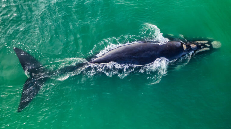
“Anywhere you are, you’re bound to see life,” says Sullivan of the ocean. “All sorts of different life forms, from charismatic creatures—we all think of the whales and dolphins—down to really unique and exotic small forms that are exquisitely adapted to these very strange environments.”
That, she says, is the majesty and the wonder of the deep sea—the endless opportunities for discovery, the ability to appreciate how other organisms have adapted to a world that would kill us instantly if it were not for a small, man-made craft. And in addition to the organisms that live within Challenger Deep, there is a new topography to map, a task for which Sullivan had been preparing all her life.
Sullivan’s dive was just one in a broader expedition spearheaded by Vescovo, who has traveled to the bottom of all five oceans, to accurately map Challenger Deep using half-a-dozen submersible dives and 18 lander dives, or scientific packages placed on the bottom ahead of the submarine with multiple instruments on each to measure depth. The submarine then traverses a line and meets up with the scientific packages, and through a combination of linear traverses and multiple
instruments, they are able to make precise topographic maps.
“The goal of the dive that I went on was to do the first of those transects,” Sullivan says. “We got to the bottom, and you sit there for 15 or 20 minutes to let the surface ship ping on you and triangulate as precisely as possible the actual position where you landed. And then we began to traverse towards the first lander, cruising along 3 to 6 feet above the bottom.”

Sullivan and Vescovo were supposed to meet up with three landers, but a battery problem prevented them from making it past the first, and they returned to the surface after approximately 1.5 hours of exploring. “That’s how things go,” she says casually with a laugh.
A restless mind. A curiosity that continues to grow. Sullivan is not one to rest on her laurels, to retire from her life’s pursuit of exploring as much of the known universe as possible. But what can possibly satisfy that passion for exploration when she has covered more vertical miles than any other person on the planet?
“There’s a dictionary definition of exploring, which involves going someplace to see what’s there. But over a lifetime of doing a good share of that, I’ve come up with a different definition,” Sullivan says. “Exploring to me is just curiosity in action.” Whether that curiosity involves launching into outer space, descending to the bottom of the ocean, or delving inward—probing something of a smaller physical scope—Sullivan is confident that she has much left to discover.
“I don’t know what mixture of physical adventures or calmer exploration lie ahead, but I’m not at all worried about running out of things to explore,” she says. “That is not going to be a problem.”