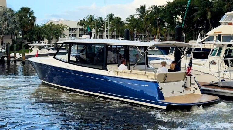
Most boaters carry around a powerful and easy-to-use computer in their pockets. Smartphones have enough processing power, sensors and capabilities to augment your onboard nav equipment. Mobile and tablet apps for boating offer a compelling set of functionalities that can make our favorite pastime safer and easier.
Although the functionality of mobile apps has improved greatly, they’re not a substitute for MFDs and other equipment. (I believe boaters should have at least one dedicated display on board.) Mobile devices are much more susceptible to moisture, heat, dead batteries and falling overboard than single-purpose hardware installed on the boat. In my own cruising, I’ve dealt with apps crashing, batteries dying and iPads overheating and shutting down from direct sunlight. But, as a supplement or backup to dedicated devices, apps deliver ever-impressive capabilities.

Navigation Apps
In the last decade, navigation apps have matured to the point where their features and functions rival, and in some cases even beat, dedicated hardware. One of the biggest advantages of a mobile device (whether it’s a phone or tablet) over installed hardware is a more readily available internet connection that makes updating charts and other data easier. Installed hardware requires multi-step processes to update, and in practice, often results in less frequent updates.
The highly responsive touchscreen interfaces and flexibility to plan your travels away from the helm make apps great planning tools. The inclusion of tide information, weather forecasts and bridge and lock schedules make them especially useful for building a float plan.
Navionics
Navionics is a full-function navigation app that has recently received a number of new features. It’s also easy to use. (Think Google Maps easy.) The core features that have made Navionics one of the leading navigation apps are their dock-to-dock auto-routing, community-sourced SonarCharts, easily downloaded daily chart updates and a responsive, easy-to-use display. In the last year, Navionics has added support for Active Captain crowdsourced data and display of AIS data from an onboard AIS receiver.
Navionics also supports its SonarCharts functionality. SonarCharts Live records depth data from a depth finder and displays it in real time on your chart within the app. That data is also recorded and shared with Navionics, who then processes the data and creates a SonarChart layer within their charts based on the data received from boaters using the Navionics app or an MFD capable of recording and uploading SonarChart data.
Apps can be useful planning tools that allow you to plot your travel course from the comfort of a couch. But, Navionics does one better with Plotter Sync. If you’re using a B & G, Lowrance, Raymarine or Simrad MFD, you can synchronize your routes between your MFD and the Navionics app by using your MFD’s WiFi connection. Navionics sells its app as a subscription service with a $22 annual fee.
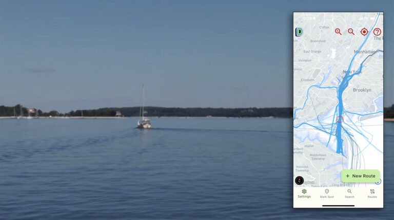
Aqua Map
Aqua Map is a newer entrant into the navigation marketplace, but they’ve quickly built a capable app with an impressive set of features. Aqua Map supports several major features important to many boaters, and has a few entirely unique features. It displays both Waterway Guide and Active Captain crowdsourced points of interest to provide information on marinas, anchorages, hazards and navigational features. The app also has a highly capable anchor alarm that makes monitoring your boat’s position at anchor easy and accurate. U.S. and Canadian charts are available with lifetime updates included.
Aqua Map has added a feature set called Aqua Map Master, available as a $10 per year add-on. Master includes the ability to display Army Corp of Engineers (USACE) surveys overlayed onto your charts. Master also includes Route Explorer and the ability to display AIS and instrument data display. Aqua Map Master’s greatest value is revealed when traveling in shallow waters, areas with hazards and under bridges. Many of the features were developed for cruising the ICW.
Before you even warm up your engines, Route Explorer’s capabilities will alert you to pertinent planning info such as hazards on the route, the bridges you’ll encounter and potential fuel stops. Aqua Map makes navigating in skinny water a little easier by overlaying the USACE survey data over the chart display. The survey data gives good visual clarity of where the deepest water can be found in problem areas. The USACE has made survey data available for many years, but it’s only been available via district websites in PDF or Google Earth files. Aqua Map easily displays the surveys, and updates them using their chart update functionality.
iNavX
iNavX is one of the pioneers in providing navigation functionality in a mobile app. They have been offering marine navigation since 2008, and have built a lot of functionality into the program, but it comes with a steep learning curve. iNavX calls their app a handheld chartplotter, and they’ve got a complete set of features to back it up. iNavX costs $5 with access to free NOAA charts. Additional charts are available within the chart store built into the app.
The app supports the broadest range of chart sources of any mobile app, including Navionics, NOAA, Canadian Hydrographic Service, Explorer Charts’ Bahamas Charts, Blue Latitude’s Mexico charts, NV Chart’s worldwide coverage and Delius Klasing European charts. Plus, iNavX displays their weather and Waterway Guide companion content as chart layers, allowing you to display additional information on top of your chart.
Like Navionics and Aqua Map, if your boat is equipped with an AIS module and WiFi gateway, iNavX can display AIS and other information from your boat’s navigation system. But, unlike the other two packages, iNavX can still display AIS information even if you don’t have an AIS receiver or transceiver on your boat. Using their AIS Live service, iNavX uses a series of receiving stations to transmit AIS information to your mobile device via the internet. This data isn’t updated as quickly as the information coming directly from an onboard AIS receiver, but can be a useful alternative if you don’t have AIS equipment on board.
Safety and Support
Boating apps aren’t limited to just navigation. The United States Coast Guard and Boat U.S. both have apps aimed at making boating safer and easier. The Boat U.S. app allows you to check the weather, look for discounts in your area, check your membership and insurance status and even call for a tow. The Coast Guard’s app allows you to fill out a float plan and file it with friends and family. Additionally, the app provides a way to report hazards, pollution or suspicious activity directly to the Coast Guard. Plus, the Coast Guard app provides information on recommended and required safety equipment, access to the rules of the road, state boating regulations and a means to request a safety check from the Coast Guard Auxilary.
Power On Demand
Many recent mobile phones—including all iPhone 8s and later as well as Samsung Galaxy S6s and later—have the ability to charge wirelessly, and nearly all use the Qi (pronounced chee) wireless charging standard. This technology allows you to simply place your phone on a wireless charging pad. Scanstrut’s ROKK line of wireless chargers is made for boaters and features a broad range of mounting options for use in the cabin as well as at the helm. Their latest, the ROKK Wireless Edge, has a ball mount, spring loaded clamp to securely hold your phone, is waterproof, accepts 12 or 24 volt D.C. power and can charge your phone at 1 amp, which is about the amount of power navigation apps draw. These mounts can help make your phone an even better companion at your helm, both holding your phone securely and keeping it charged.
The combination of these apps and a mobile device might not be full-fledged replacements for the dedicated and installed equipment on board your boat. However, they can make your boating easier and more pleasant. They keep information at your fingertips, keep you updated when conditions change and can even summon help when you need it.