Inlet Navigation Safety Tips
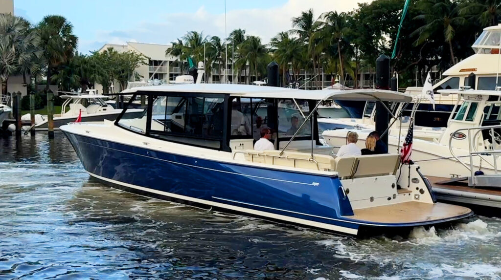
Inlets can be tricky. Here’s some expert advice to help you avoid a harrowing tale.


Inlets can be tricky. Here’s some expert advice to help you avoid a harrowing tale.
Volvo Penta showcases their game-changing Dock Assist technology. Wind, current and fear while docking might just become a thing of the past.
An AI twist on chart plotting adds historical data to the mix.

The next step in mapping, LiDAR utilizes high-tech lasers to give us the most accurate maps yet.
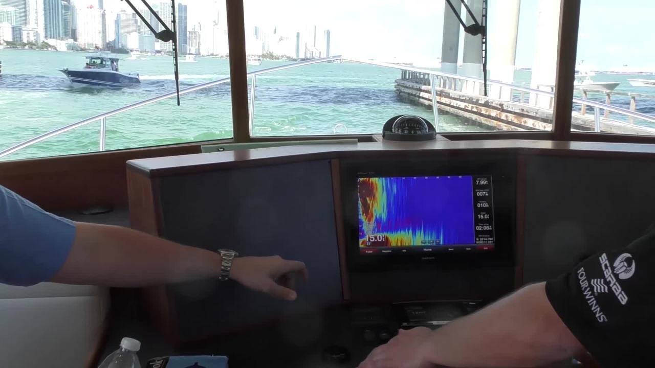
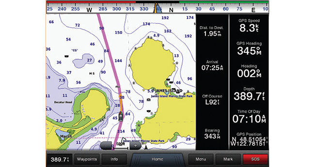
Garmin’s new 742xs GPS Plotter is easy to install and intuitive to use, making it a great addition to any cruise. The Power & Motoryacht crew tested it on Capt. Bill Pike’s Betty Jane II.

Focus on what’s really important, the safety of you and your family on your boat. You may be surprised to learn how radar fits into the equation. Get the whole story here.
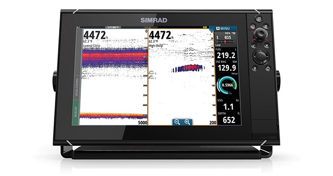
The Simrad S5100 has three independent sonar channels that offer high-resolution sonar function throughout water column depths. With the S5100 boaters and anglers can link to either three single-channel transducers or an array including one dual-channel and one single-channel.
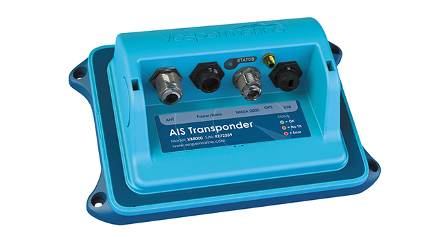
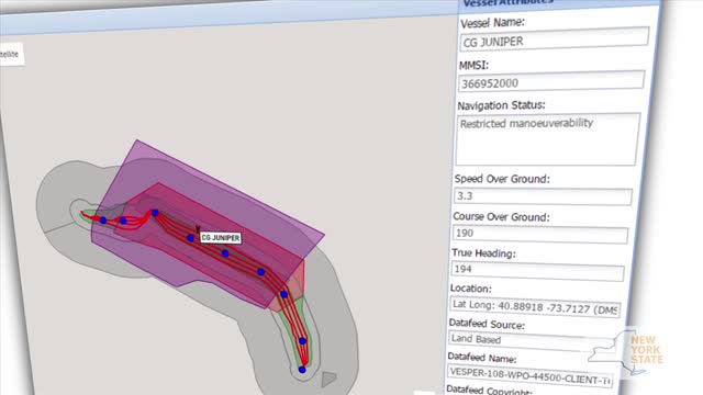
Vesper Marine has added new functionality to its black-box XB-8000 AIS transponder. The system adds a layer of safety through active alarms that monitor potential collision threats and alert the user. According to Vesper Marine, smartAIS uses navigation-sensor, GPS, and AIS data to prioritize alerts.
Anglers will flock to the bird mode feature, in which birds are readily marked without tuning the unit, and then tracked simply with an echo trails feature.
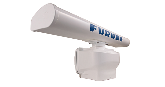
Deputy Editor Jason Y. Wood checks out the new Garmin Phantom Radar.
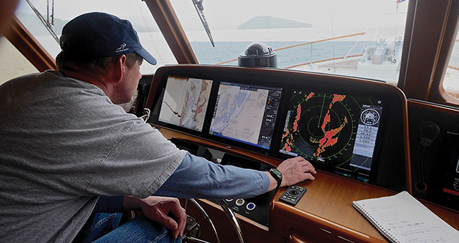
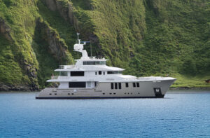
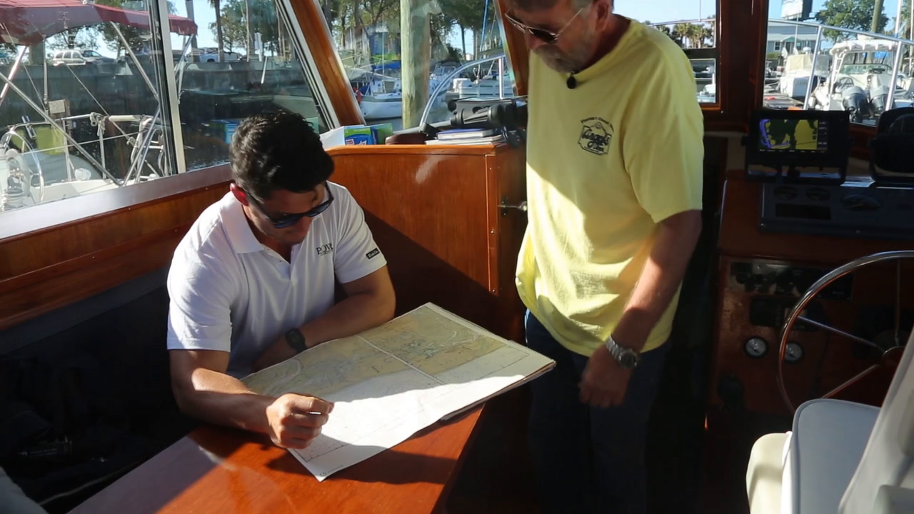
How do you think about refitting your electronics when you’re an intrepid offshore cruiser? We asked Tony Fleming of Fleming Yachts just that. Learn from his experience here
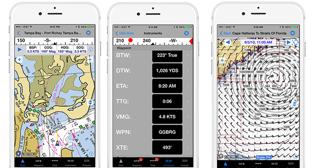
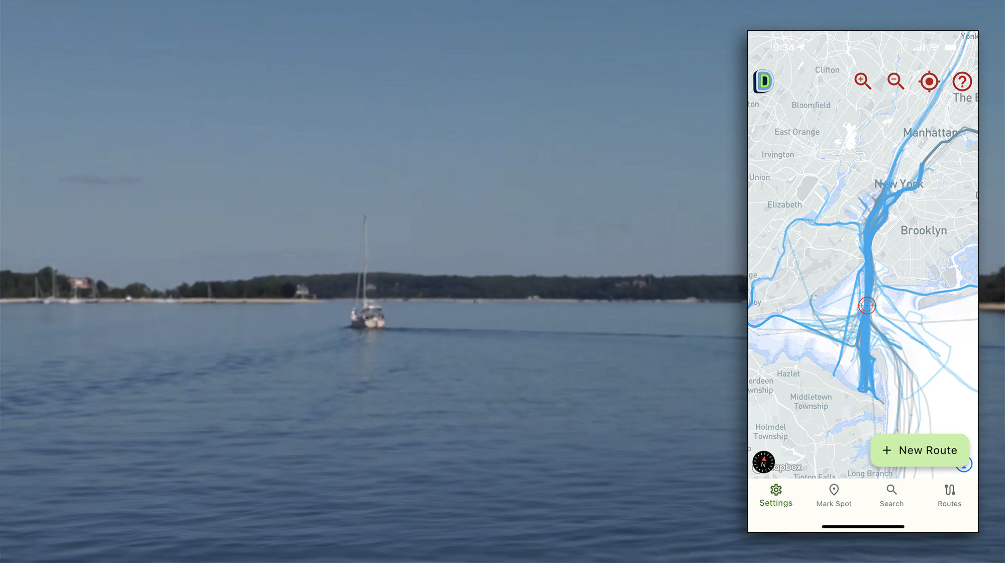
The makers of the iNavX marine navigation mobile app have improved its function and practicality to make the data that boaters need more accessible. The app, introduced in 2008, brought a variety of cartography sources to Apple iOS iPhones and iPads.
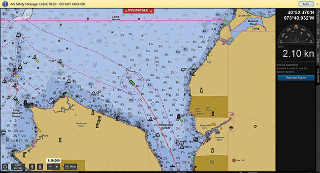
Vesper Marine explores innovative ways to use AIS and employ the powerful warning and messaging capabilities embedded in the system. The company just launched a project to mark a no-anchor zone over some seabed power cables and we saw it in action.
How Vesper Marine is using AIS to create virtual buoys to protect power cables for the New York Power Authority in the Long Island Sound.
Garmin released new versions of its proprietary BlueChart cartography earlier this year, and improved the accuracy of its underwater structural details, including 1-foot HD fishing contours.
Inlets can be tricky. Here’s some expert advice to help you avoid a harrowing tale.
Volvo Penta showcases their game-changing Dock Assist technology. Wind, current and fear while docking might just become a thing of the past.

An AI twist on chart plotting adds historical data to the mix.
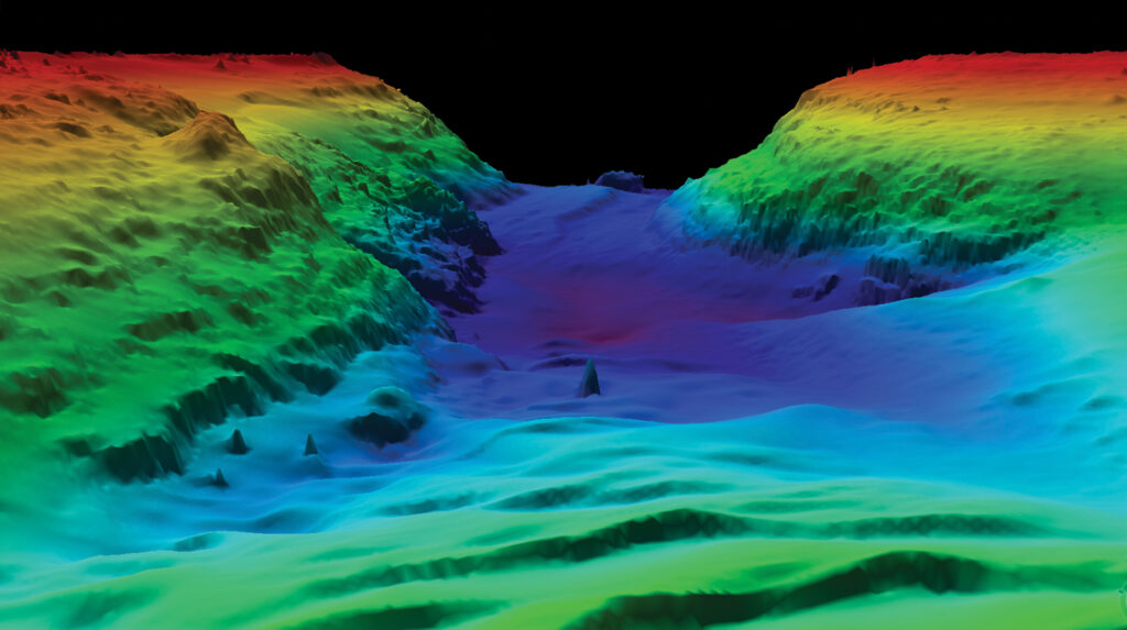
The next step in mapping, LiDAR utilizes high-tech lasers to give us the most accurate maps yet.

Garmin’s new 742xs GPS Plotter is easy to install and intuitive to use, making it a great addition to any cruise. The Power & Motoryacht crew tested it on Capt. Bill Pike’s Betty Jane II.

Focus on what’s really important, the safety of you and your family on your boat. You may be surprised to learn how radar fits into the equation. Get the whole story here.
The Simrad S5100 has three independent sonar channels that offer high-resolution sonar function throughout water column depths. With the S5100 boaters and anglers can link to either three single-channel transducers or an array including one dual-channel and one single-channel.
Vesper Marine has added new functionality to its black-box XB-8000 AIS transponder. The system adds a layer of safety through active alarms that monitor potential collision threats and alert the user. According to Vesper Marine, smartAIS uses navigation-sensor, GPS, and AIS data to prioritize alerts.
Anglers will flock to the bird mode feature, in which birds are readily marked without tuning the unit, and then tracked simply with an echo trails feature.

Deputy Editor Jason Y. Wood checks out the new Garmin Phantom Radar.
How do you think about refitting your electronics when you’re an intrepid offshore cruiser? We asked Tony Fleming of Fleming Yachts just that. Learn from his experience here
The makers of the iNavX marine navigation mobile app have improved its function and practicality to make the data that boaters need more accessible. The app, introduced in 2008, brought a variety of cartography sources to Apple iOS iPhones and iPads.
Vesper Marine explores innovative ways to use AIS and employ the powerful warning and messaging capabilities embedded in the system. The company just launched a project to mark a no-anchor zone over some seabed power cables and we saw it in action.
How Vesper Marine is using AIS to create virtual buoys to protect power cables for the New York Power Authority in the Long Island Sound.
Garmin released new versions of its proprietary BlueChart cartography earlier this year, and improved the accuracy of its underwater structural details, including 1-foot HD fishing contours.