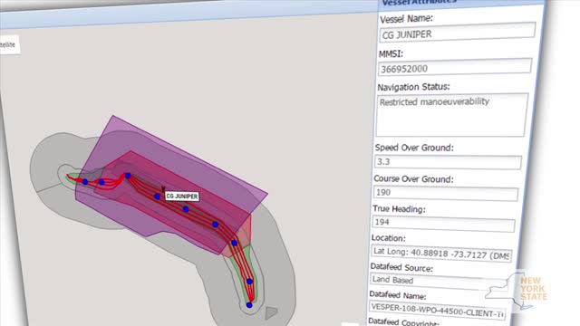
Virtual Buoys in the Long Island Sound
How Vesper Marine is using AIS to create virtual buoys to protect power cables for the New York Power Authority in the Long Island Sound.


How Vesper Marine is using AIS to create virtual buoys to protect power cables for the New York Power Authority in the Long Island Sound.
Garmin released new versions of its proprietary BlueChart cartography earlier this year, and improved the accuracy of its underwater structural details, including 1-foot HD fishing contours.
SonarChart Live is a Navionics feature add-on to a recent update of Raymarine’s Lighthouse II operating system that allows users to create bathymetric charts in real time.
AIS is a powerful system for helping boats avoid collisions, but that’s just scratching the surface of its capability. Case in point: A smart virtual buoy system coming online soon that will protect power lines on the seabed of Long Island Sound.
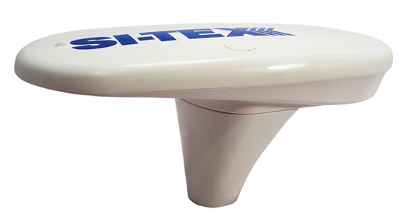
The SI-TEX Vector compact GPS compass contains a pair of GPS receivers matched to a single clock for precise heading and boat position information.
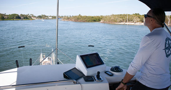
Technology really stands out when stacked alongside a seasoned cruiser. Check out Arawak’s Simrad helm system.
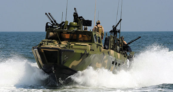
Earlier in the year two U.S. Navy Riverine Commnad Boats found themselves embarrassingly off course in Iranian waters. The Navy blamed navigational error but is that what really happened? Capt. Bill Pike conducts an exclusive investigation.
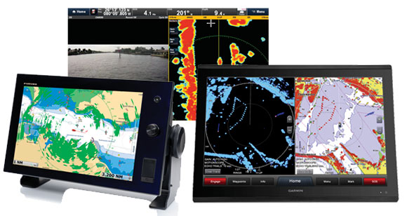
Radar technology has recently gone in a radical new direction thanks to solid-state technology; Jason Y. Wood explains what this means for you and your helm.
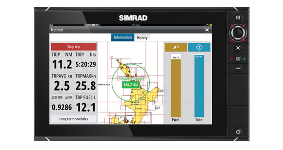
Simrad’s TripIntel navigational interface shares voyaging data in a real-time format that’s easier to use and understand for cruising boaters.
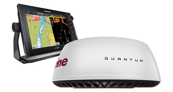
The first recreational marine radar dome that uses CHIRP pulse-compression to deliver radar imaging effectively at both long and short ranges.
The voodoo that GPS does is pretty simple, actually. Understanding why it fails means you’ll be ready when it happens. Have a closer look at this key navigation device here.
The PS60 allows Garmin to add performance to its triple-threat Panoptix sounder system.
The Garmin GMR 2524 xHD2 seems to have a lot to offer in its capabilities, particularly something called Pulse Expansion.

Radar for the Rest of Us
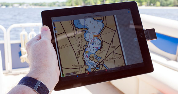
Do you really need more than a tablet and some apps to navigate?

How Vesper Marine is using AIS to create virtual buoys to protect power cables for the New York Power Authority in the Long Island Sound.

Garmin released new versions of its proprietary BlueChart cartography earlier this year, and improved the accuracy of its underwater structural details, including 1-foot HD fishing contours.

SonarChart Live is a Navionics feature add-on to a recent update of Raymarine’s Lighthouse II operating system that allows users to create bathymetric charts in real time.

AIS is a powerful system for helping boats avoid collisions, but that’s just scratching the surface of its capability. Case in point: A smart virtual buoy system coming online soon that will protect power lines on the seabed of Long Island Sound.

The SI-TEX Vector compact GPS compass contains a pair of GPS receivers matched to a single clock for precise heading and boat position information.

Technology really stands out when stacked alongside a seasoned cruiser. Check out Arawak’s Simrad helm system.

Earlier in the year two U.S. Navy Riverine Commnad Boats found themselves embarrassingly off course in Iranian waters. The Navy blamed navigational error but is that what really happened? Capt. Bill Pike conducts an exclusive investigation.

Radar technology has recently gone in a radical new direction thanks to solid-state technology; Jason Y. Wood explains what this means for you and your helm.

Simrad’s TripIntel navigational interface shares voyaging data in a real-time format that’s easier to use and understand for cruising boaters.

The first recreational marine radar dome that uses CHIRP pulse-compression to deliver radar imaging effectively at both long and short ranges.

The voodoo that GPS does is pretty simple, actually. Understanding why it fails means you’ll be ready when it happens. Have a closer look at this key navigation device here.

The PS60 allows Garmin to add performance to its triple-threat Panoptix sounder system.

The Garmin GMR 2524 xHD2 seems to have a lot to offer in its capabilities, particularly something called Pulse Expansion.

Radar for the Rest of Us

Do you really need more than a tablet and some apps to navigate?


