C-Map Plan2Nav Mobile App
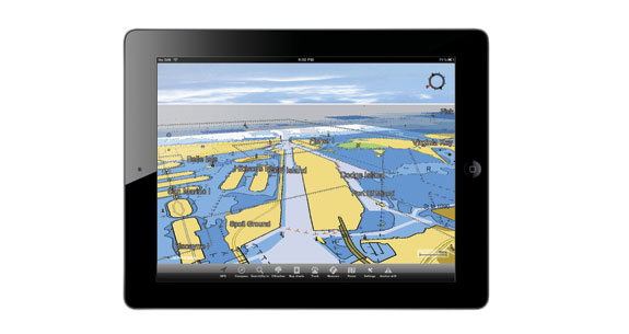
The Plan2Nav app from C-Map provides chartplotting capability to GPS-enabled handheld mobile devices such as the iPhone, iPad, and iPod, as well as those with the Android operating system.


The Plan2Nav app from C-Map provides chartplotting capability to GPS-enabled handheld mobile devices such as the iPhone, iPad, and iPod, as well as those with the Android operating system.
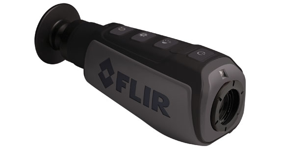
FLIR’s new handheld thermal-imaging scope uses Instalert to help you to find your target.
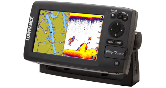
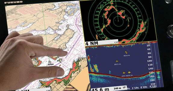
Charts and fishfinding functions share the screen seamlessly in the Lowrance Elite 7 HDI.
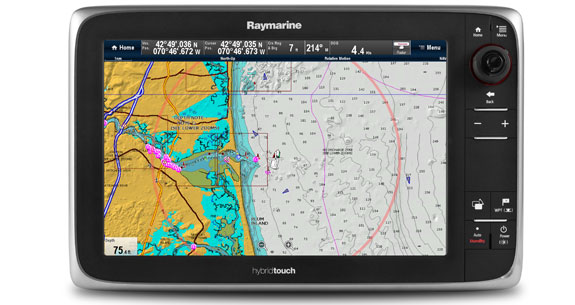
Raymarine updated its LightHouse software, which directs the user experience for the company’s a-, c-, and e-Series multifunction displays.
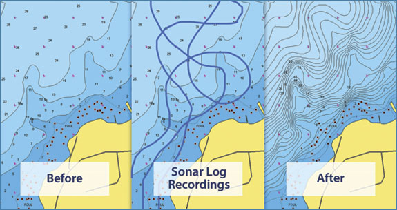
Navionics’s SonarCharts use sonar logs from users, along with data from the hydrographic office and proprietary surveys to add detail to a layer of cartography.
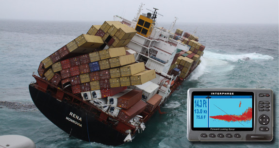
As Interphase Technologies joins Garmin, forward-looking sonar may get a boost.
How To Double Down on Radar
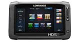
You may not have looked at Lowrance lately. That’s because you’ve never seen anything like this before: The HDS-9 Gen2 Touch. It’s got a lot of functions you may decide you can’t live without. And you don’t have to, anymore. Check it out here.
Your helm may create its own Wi-Fi network and share data with you wirelessly.
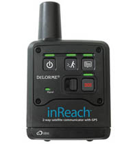
A two-way satellite communicator with GPS, the InReach belongs to an exciting and relatively new category; it’s a Satellite Early Notification Device (SEND).
The NavNet TZtouch multifunction diplay is the first ever to boast dual-touch screens with functionality like an iPad.
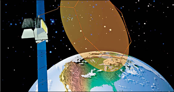
Defending the bandwidth for GPS.
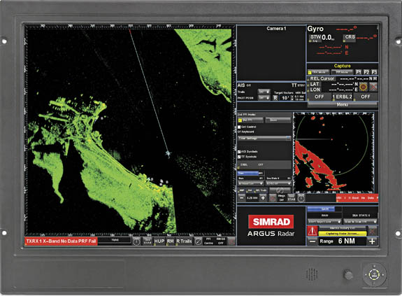
Simrad adds the radar technology it developed for recreational boats to a system for ships and megayachts.
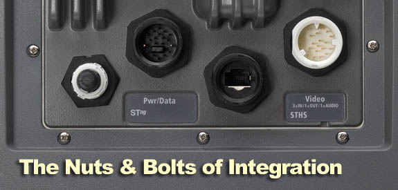
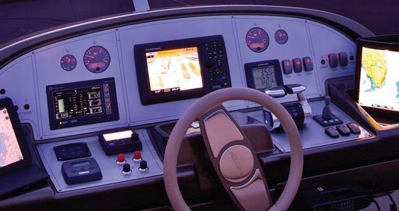
Know how the components of your helm—and the rest of the boat—communicate.
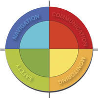
Think about each component of your boat’s electronics to create a powerful system that’s greater than the sum of its parts.

The Plan2Nav app from C-Map provides chartplotting capability to GPS-enabled handheld mobile devices such as the iPhone, iPad, and iPod, as well as those with the Android operating system.

FLIR’s new handheld thermal-imaging scope uses Instalert to help you to find your target.

Charts and fishfinding functions share the screen seamlessly in the Lowrance Elite 7 HDI.

Raymarine updated its LightHouse software, which directs the user experience for the company’s a-, c-, and e-Series multifunction displays.

Navionics’s SonarCharts use sonar logs from users, along with data from the hydrographic office and proprietary surveys to add detail to a layer of cartography.

As Interphase Technologies joins Garmin, forward-looking sonar may get a boost.

How To Double Down on Radar

You may not have looked at Lowrance lately. That’s because you’ve never seen anything like this before: The HDS-9 Gen2 Touch. It’s got a lot of functions you may decide you can’t live without. And you don’t have to, anymore. Check it out here.

Your helm may create its own Wi-Fi network and share data with you wirelessly.

A two-way satellite communicator with GPS, the InReach belongs to an exciting and relatively new category; it’s a Satellite Early Notification Device (SEND).

The NavNet TZtouch multifunction diplay is the first ever to boast dual-touch screens with functionality like an iPad.

Defending the bandwidth for GPS.

Simrad adds the radar technology it developed for recreational boats to a system for ships and megayachts.

Know how the components of your helm—and the rest of the boat—communicate.

Think about each component of your boat’s electronics to create a powerful system that’s greater than the sum of its parts.


