

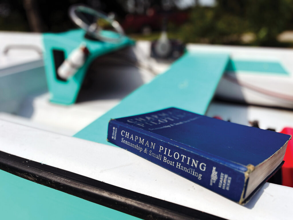
Piloting, Seamanship and Small Boat Handling, by Charles F. Chapman, has been the handbook of boating for more than 100 years. The first edition was published in 1922; the latest is now called Chapman Piloting and Seamanship. It’s a svelte 920 pages. I have the 1966 edition, bought new for $5.99, according to the price penciled on the inside front cover. Back then, six bucks would buy 12 gallons of gas and oil for my aluminum skiff, so buying a copy was considered an investment. (Today’s edition, now lists for $65. Buy a copy. There’s a lot worth browsing inside.)
I hadn’t looked into my old Chapman’s in quite a while, so when I did, I was reminded how much boating has changed in the past 60 years—mostly, but not all, for the better. Some things have been lost that I think we should have saved, while others are just different, an inevitable result of the march of time. Thankfully, the editors of the latest edition kept many traditional skills and gear, even though they’re not used much anymore. Doing things the “old way” is often both fun and instructive, and might come in handy someday. It’s usually more satisfying to figure things out yourself rather than rely on technology, too.
Where Are We?
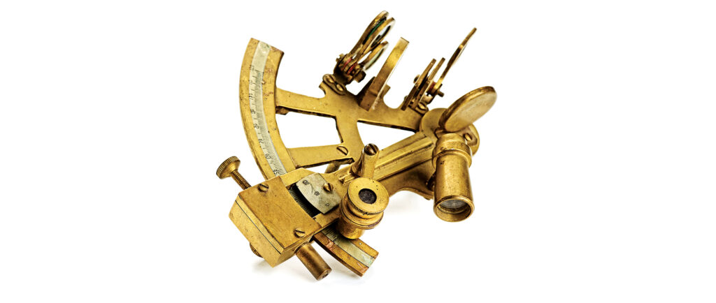
Take piloting, for example. Chapman’s still dedicates many pages to piloting using traditional tools—paper charts, tide tables, parallel rules, dividers, and a hand-bearing compass. There’s instruction on solving current diagrams using vector triangles of velocity, e.g., figuring out what compass heading to follow to go from point A to point B when there’s a strong current running across your course that will push your boat one way or the other. Vectors were new in the ’66 edition, but anyone who cruised in current-crossed water already knew how to use them.
Piloting using traditional skills is satisfying if you get it right—maybe not so much if you get it wrong. It takes practice, a place to lay out charts, and skill with parallel rules and dividers. Skippers would plan their trips with their charts unfolded on the kitchen table at home, rather than on a small chart table on board. The best navigators worked out their vector triangles on plotting sheets, so they didn’t mark up their charts. Piloting underway in rough weather could be challenging—pointy dividers love to fly off the chart table and stick in your leg—but eventually you got the hang of it, and it felt good when you arrived at your anchorage safely, or mostly so, anyway. Most boats don’t even have chart tables anymore, or paper charts, either, which I think is too bad.
Today, electronics does the piloting for you; just follow the track on your chart plotter. It’s easier, more accurate and safer, but also takes away the sense of accomplishment. yet when you’re stuck in the fog with boats all around, horns blaring in every direction and jagged rocks somewhere off to starboard, you don’t look for your parallel rules—you use the radar, GPS, and chart plotter. I keep my radar warmed up even on sunny summer afternoons. But why not invest in a couple of charts and then, when the weather’s fine, get out the tools and do it by hand? You can unfold the chart on the galley table, taking care not to make holes in the varnish with the dividers. You’ll learn the skills pretty quickly, and can check yourself with the electronics.
Mad Scientist At Work
My old Chapman’s had a surprisingly long chapter on electronics, most of which is antiquated today. When was the last time you received Consolan signals on your RDF, for example? Given only a couple of paragraphs was my favorite electronic navigation system of all time, Loran. Today we’d call it Loran-A, to differentiate it from the improved Loran-C—but that was years in the future in ‘66. Loran used coordinated signals broadcast from two antennas linked to one station; how far apart, in time, the signals from the antennas were received gave you a line of position (LOP) for that station. Doing this for two, or, ideally, three Loran stations gave you a position where the LOPs crossed. (GPS works on time differences, too, but the signals come from satellites, not terrestrial transmitters.)
The Loran receiver was basically an oscilloscope with blips marching across its face. You determined which two blips corresponded with the Loran station you were working (took a little practice to do this), lined them up as precisely as possible by clicking five or six knobs on the Loran set, then read off the resulting numbers. You plotted that number on the chart, on a network of faint colored lines corresponding to Loran TDs for that station. That gave you one LOP; you were somewhere on that line.
To get a position, you’d work and plot an LOP from a second Loran station and, ideally, a third. (Two LOPs can be way off and you won’t know it, so a third acts as to confirm the other two; this is true whenever you’re taking bearings, doing celestial navigation, anything that involves lines that cross: You always want three.) If all was well with the universe, the three LOPs would cross fairly close to one another—the triangle formed by three LOPs is called a “cocked hat,” and you want the hat to be as small as possible. If you had three stations, Loran was usually pretty accurate. I loved using the Loran, especially at night, when the green light from the scope blended nicely with the red night light at the chart table. It had kind of Mad Scientist feel about it that I miss.
Getting Magnetic
The magnetic compass used to be the primary navigational tool, and every boat still has one, but how often do most of us use it now that we have electronics? I know skippers who use the compass not as a piloting tool, but as a keeper for their baseball caps so they don’t slide onto the deck. But when your electronics go, the compass will be your best friend, guiding you home along the earth’s magnetic field like a seeing-eye dog. Find somewhere else for your hat. Chapman’s in ’66 had a comprehensive chapter on the compass, and the newest edition has one that’s even better.
Compasses are rarely dead-on accurate, so you need to determine how inaccurate they are. There are two sources of error: Variation is the difference between true and magnetic directions caused by the separation between the magnetic and terrestrial poles. It’s the same for all compasses in the same geographic area; it changes gradually as you move from one place to another. It also changes over time, but very slowly. When piloting with paper charts, most navigators use the magnetic compass rose, which compensates for variation.
Deviation is compass error caused by your own boat, by ferrous metals or electrical fields that affect the compass. It varies with the boat’s heading. Deviation can be offset using compensating magnets; they are usually built into the compass, but sometimes extras are required. Traditionally, a professional compass adjuster would do this when the boat was new, but today it’s often not done.
Check your deviation by using your chart plotter or GPS to determine the magnetic course to a lighthouse, point of land, fixed navigational mark, etc. Steer carefully for the mark and see what your compass reads. Note any difference in your log. Do the same thing at different headings; the more headings and errors you have, the better. Record everything so if your electronics go down and you have to steer by compass, you’ll know how to compensate for deviation on any particular heading. Or call a pro to adjust the compass and work up a proper deviation table. Then start steering by compass like they used to do in the old days. Maybe eventually you’ll forget even to turn on your plotter.
Messing About in Boats
Chapman’s used to be titled Piloting, Seamanship and Small Boat Handling, and my 1966 edition has many pages on managing boats in tough conditions, including lifeboat seamanship under oars, handling boats in heavy surf, seamanship in large seas, using a sea anchor, even the use of oil to calm breaking seas when hove-to. You won’t find many handbooks recommending that today—although if the option is being rolled by breakers, I’d start dripping motor oil overboard ASAP—but the other skills can still come in handy. Rowing, for instance: Not enough people row today, and they’re missing a very pleasant pastime.
Most boats now carry inflatable dinghies or RIBs, both of which row like washtubs. Since everybody also carries an outboard, it doesn’t really matter. But wrestling with the motor; clamping it onto the dink; taking it off the dink; stowing it; keeping fuel for it, or charging its battery; worrying that someone will steal it from the dinghy dock—all the annoyances that go along with an outboard: Why not invest in a hard dinghy that rows decently and make your life easier? It doesn’t take long to get the hang of rowing if you have a decent boat. Maybe your kids will pry themselves away from screens now and then and get some exercise at the oars; maybe you will, too.
The classic do-it-all dink is the 9-foot Dyer Dhow, built since 1949 by The Anchorage in Warren, Rhode Island. At just over 100 pounds, the fiberglass Dhow is tough, demands little maintenance, can be carried on almost any davits, and is easy to manage even for kids. It rows fine, and can handle a small outboard when necessary. If you want something a little sleeker and a little better for rowing, get the 10-foot Dyer Dink. There’s also an 8-foot Midget, if you need something smaller. (No, I’m not in the employ of The Anchorage; I just think they build nice dinks that make messing about in boats a lot more fun.)
So put away the foot pump and the gas can, get out a nice pair of varnished spruce oars, and mooch around the harbor on a calm summer morning. Learn to feather your oars and you’ll look like a pro. Afterwards, you might want to try more skills of yesterday that we no longer use today—could be you’ll discover a whole new aspect of boating. But don’t ask to borrow my old Chapman’s: I paid six bucks for it, and I’m not letting it out of my sight!
This article originally appeared in the November 2025 issue of Power & Motoryacht magazine.


